We awoke the morning of the 30th to much calmer weather than the night before. Still some wind, but not gales. And a brief break from the rain.
We didn't have too far to climb to reach the top of the road, and then we descended into Kylerhea- a super fast downhill.
At the bottom of the hill was our goal: a short community-owned ferry back to the mainland at Glenelg. According the the authorities- this is the site of the oldest ferry to/from Skye, although the exact date of origin is unsure, there was definitely a ferry at the site during Boswell and Johnson's visit in 1773. Rolling in to the ferry pier, we saw this road sign:
Not clear what they're trying to say here ... Maybe that ferry traffic should drive off the pier? Perhaps if you want to board the ferry you should precariously perch your car by the rear wheels?
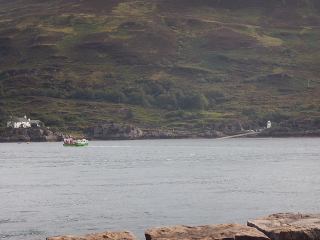
Here's the ferry coming from the Glenelg side:
Here's a close-up as the ferry prepares to unload:
You might notice that the ferry is pointed almost directly at the camera, whereas the car deck is pointed off the side. This is a "turn-table" ferry, and happens to be the last one operating in the world. The cars load onto the rotated deck, and then the crew rotates the car deck - entirely by their own muscle power - so the cars are pointed to the front of the ferry. When the ferry arrives at the other side, the deck is rotated to the side and the cars drive off forward. The new cars load by driving onto the ferry, pointed more or less to the back of the boat, and then the crew again rotates the deck. Here's a wee video showing the arrival and off-loading:
Here's the ruins of the Bernera Barracks. Used by the English after the Jacobite uprising of 1745, as a means to control the sea traffic to/from Skye.
After leaving Glenelg, we went to the Glenelg Brochs, ancient stone structures that stood over thirty feet high. Here's two pictures of the Dun Telve broch.
Brochs are found all over Scotland, and some date back as far as 4000 years ago. Their original function is hotly debated: they could have been the home of the highest "ranking" village elder, they could have served a defensive function, or they could have been the home of the wealthier members of the society. The exact interior configuration is not known, but it is known at they were roofed and had fire pits centrally located, and they were inhabited.
The walls are hollow, which allowed them to be built so tall and strong, and the interior cavities were probably used for storage. Here is an artist's depiction of what life may have been like inside of a broch.
At Glenelg, two Brochs are very closely located. This proximity confuses archaeologists because it's unusual to have two so near to each other. This one is the Dun Troddan broch:
We left the Brochs and passed through Glenelg for lunch at the community center (taking shelter under the solar panels when it started raining ... talk about sick irony!)
We started a long climb up the Mam Ratagan ... A hill that went on seemingly forever! In fact, it went right up into the clouds! Along the way we found one of the loneliest looking post boxes we've seen:
After the sweaty slog, which turned into a rainy and sweaty slog, we topped the pass above Shiel Bridge for this view:
The plaque in the foreground lists the Five Sisters of Kintail - five gloriousously scenic peaks overlooking Lock Duich, and a favorite destination of hill walkers and peak baggers. We hear it's a beautiful, breath-taking view. Today, they're wet.
Aaaaaaaand so were we.
We descend the hill - white knuckles clenching the brake levers all the way - into Ratagan and over the Shiel Bridge.
We rode our way around Ratagan for a bit, and decided that since we were wet and feeling worn down we'd stay at the hostel (another of the older hostel gems of Scotland- dating back to 1932, shortly after the start of the hostel movement). So ended the 30h of August.
The 31st looked promising at the start...
This is looking over Loch Duich. Beautiful!
Our goal for the day was to make Drumnadrochit near the top of Loch Ness. Let's go!
It was not long before we were warned thusly:
Feral goats??? Yikes!
Thankfully, the ride was uneventful. We turned off the A87 and onto the A887 and passed over the Ceannacroc Bridge.
Some of our roadside friends. Nice to look at, but not much for conversation. In fact, they are generally so busy eating that they won't even look up at us! That Scottish grass must be pretty captivating! And given their size- they have to eat a lot of it...
Sixteen miles later we made Invermoriston, on the banks of Loch Ness. At Invermoriston is a beautiful bridge, one of the many Telford Bridges throughout the country. Telford was an architect from Aberdeen who was employed to help build the road and bridge network that connected the remotest parts of Scotland to the established road network in the early 1800's.
Telford bridges are quite beautiful, and often times use landscape features in their structure.
This picture shows the Telford Bridge, completed 1813, as well as the new bridge on the A887. The new bridge was built in 1933...
Also threw a few pence into St. Columba's well, not far from these lovely bridges. St Columba supposedly banished some evil water sprit from this well during his journey to the area in approximately 580AD, and since this time, the water has been thought to be healing.
After Invermoriston we turned north on the A82. Not a fun road because it's narrow and very heavily trafficked.
Here's a memorial to John Cobb, who died trying to set the world speed record on water in the first ever jet powered boat.
Here's one of our best views along Loch Ness. And look! The rain is coming!! Undaunted, we powered on through the rain...
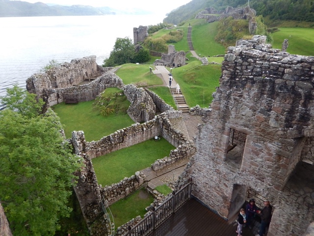
To the Castle Urquhart!
The castle has a fascinating story, with the written history dating back to 580 when the Irish priest St Columba came to visit the Pictish fort and convert the elders to Christianity. In about 1220 the first castle was built over the ruins of the Pictish settlement. Since then the history has been very complicated, and the castle has changed hands many times. It's a fascinating read, and far too much for us to encapsulate here.
We left the castle, in the rain, and opted again for a hostel in Drumnadrochit to take a night to dry out (again) and celebrate Melinda's birthday!
We snacked (and beered) at the Loch Ness Brewery, and then a wonderful home made dinner at the hostel.
Toward the end of the night, Melinda started feeling a bit off, but nothing that a good night sleep can't resolve.
On the morning of the first we headed south on the A82. Passed again through Invermoriston, and then at Fort Augustus (in the rain) we discovered The Great Glen Way!
Riding along side The Caledonian Canal was a blessing after the crazy traffic on the A82. There was a little boat traffic, and it was fun to wave at the folks on the boat, enjoying their own adventure through Scotland. Caledonian canal, designed and managed by Telford himself, was completed in 1822, several years overdue and well over budget. It essentially connects the seas east and west through Scotland, via the Moray Firth at Inverness and the Firth of Lorne at Oban. What manpower it must have taken to create!
At the top of Loch Oich we passed the Bridge of Oich. Not a Telford bridge, but rather designed by James Dredge.
Along the canal, and everywhere else in Scotland, they take very seriously the business of Dog Fouling.
The bike path was well off the highway, through beautiful woods and glens.
We ended the day in strong rain at Laggan, staying in a hostel. Melinda was feeling pretty poor, so we appreciated the warm shelter out of the rain.
Day to day summary:
August 30 - Isle of Skye (Kylerhea) to Ratagan on backroads. Took turntable ferry to Glenelg and met with English cycle tourists for coffee at roadside. Visited Dun Telve and Dun Troddan, two iron-age brochs. Biked over the the Mam Ratagan for a tremendously foggy view of the 5 sisters of Kintail. Over the Shiel Bridge (Telford, 1804) for groceries- ended trip at the Ratagan hostel (one of Scotland's first hostels). Total 30 miles.
August 31 - Ratagan to Dromnadrochit on A87, A887, and A82. Visited memorial for battle of Glenshiel (1719), Roderick Mackenzie cairn (1746) in Glenmoriston, St. Columba's well, Invermoriston falls, Telford bridge in Invermoriston, Urquart castle, and lastly the Benleva Inn for some Loch Ness brewery beers at the end of day. All in all a fantastic birthday, minus the strange flu like illness that began late evening. Total 53 miles.
September 1 - Dromnadrochit to South Laggan via A82 and the (hallelujah!) Great Glen Way. Visited the Loch Ness Exhibit in Dromnadrochit, Urquart castle (yes, again!), the Caledonia Canal Center and the locks in Fort Augustus. Passed through Invermoriston (yes, again). 33.1 miles


No comments:
Post a Comment